Abonnez-vous aux actualités du Géoportail de la Wallonie pour rester au courant des nouveautés !
Utilisez soit notre flux RSS, soit une notification par e-mail.
Vous êtes un acteur privé ou public du secteur de la géomatique ? Partagez vos news !
Proposer l'ajoutde mon actualité
JOB - Vacancy - Mapping the different types of forest of the Congo Basin
- Offre d'emploi
- UCL
In support to the Observatoire des Forêts d’Afrique centrale (OFAC) hosted in Yaoundé (Cameroon), the Research Laboratory in Environmetrics and Geomatics of the Earth and Life Institute de l’Université catholique de Louvain, seeks qualified and highly motivated candidates for Mapping the different types of forest of the Congo Basin by high resolution satellite remote sensing (18 months, with possible renewal up to 3 years) The successful applicants will be in charge of the necessary satellite remote sensing development and of the production of national forest maps for the 10 countries of the Congo Basin (Central Africa). At the request of the COMIFAC countries, the Observatoire des Forêts d’Afrique Centrale (OFAC) delivers since 2008 on regular basis an internationally recognised report on "The State of the Forests in the Congo Basin". This report as well as the on-line OFAC information system (http://www.observatoire-comifac.net/) help the COMIFAC countries to manage their forest resources in a more sustainable way. In the context of the international REDD+ program and for their national forest plan, the COMIFAC countries recently requested detailed and up-to-date maps of the forest extent as well as the delineation of the different types of forests for their respective national territory. With the support of the European Union, the detailed forest typology, the advanced remote sensing methods, and the collaborative mapping strategy will be developed by the project team using state-of-the-art methods and the most recent technologies including the four Sentinel-1 and 2 satellites. In close collaboration with the national experts from each country and the OFAC partners, the mapping activities at 10 m resolution will include experts training, regional workshops, cloud computing and field visits in several countries of the Congo Basin. In addition, on-line data analytics will be developed to enhance the use of the OFAC website for decision makers. The remote sensing research, the data analytics as well as the map production will rely on the large experience of our lab team in the field of tropical forest remote sensing. The applicant will be: - graduated as bioengineer or equivalent ; - trained in remote sensing and geomatics ; - fluent in French and English ; - motivated to work with international research teams and national experts; - ready to actively contribute to training activities in the region. Additional experiences in tropical forest, advanced image processing and mapping activities are most welcomed. The interested candidates are invited to send a curriculum vitae and a motivation letter by email (pascale.thiran@uclouvain.be and cc: pierre.defourny@uclouvain.be ) as soon as possible and not later than the 30 September 2017 to Pr. P. Defourny UCLouvain \ ELIe_Geomatics Croix du Sud, 2 bte L5.07.16 1348 Louvain-la-Neuve Belgium
In support to the Observatoire des Forêts d’Afrique centrale (OFAC) hosted in Yaoundé (Cameroon), the Research Laboratory in Environmetrics and Geomatics of the Earth and Life Institute de l’Université catholique de Louvain, seeks qualified and highly motivated candidates for
Mapping the different types of forest of the Congo Basin
by high resolution satellite remote sensing
(18 months, with possible renewal up to 3 years)
The successful applicants will be in charge of the necessary satellite remote sensing development and of the production of national forest maps for the 10 countries of the Congo Basin (Central Africa). At the request of the COMIFAC countries, the Observatoire des Forêts d’Afrique Centrale (OFAC) delivers since 2008 on regular basis an internationally recognised report on "The State of the Forests in the Congo Basin". This report as well as the on-line OFAC information system (http://www.observatoire-comifac.net/) help the COMIFAC countries to manage their forest resources in a more sustainable way.
In the context of the international REDD+ program and for their national forest plan, the COMIFAC countries recently requested detailed and up-to-date maps of the forest extent as well as the delineation of the different types of forests for their respective national territory. With the support of the European Union, the detailed forest typology, the advanced remote sensing methods, and the collaborative mapping strategy will be developed by the project team using state-of-the-art methods and the most recent technologies including the four Sentinel-1 and 2 satellites.
In close collaboration with the national experts from each country and the OFAC partners, the mapping activities at 10 m resolution will include experts training, regional workshops, cloud computing and field visits in several countries of the Congo Basin. In addition, on-line data analytics will be developed to enhance the use of the OFAC website for decision makers. The remote sensing research, the data analytics as well as the map production will rely on the large experience of our lab team in the field of tropical forest remote sensing.
The applicant will be:
- graduated as bioengineer or equivalent ;
- trained in remote sensing and geomatics ;
- fluent in French and English ;
- motivated to work with international research teams and national experts;
- ready to actively contribute to training activities in the region.
Additional experiences in tropical forest, advanced image processing and mapping activities are most welcomed.
The interested candidates are invited to send a curriculum vitae and a motivation letter by email (pascale.thiran@uclouvain.be and cc: pierre.defourny@uclouvain.be ) as soon as possible and not later than the 30 September 2017 to
Pr. P. Defourny
UCLouvain \ ELIe_Geomatics
Croix du Sud, 2 bte L5.07.16
1348 Louvain-la-Neuve
Belgium
JOB - Vacancy - Assistant(e) de recherche et de géomatique
- Offre d'emploi
- UCL
Afin d’assurer la formation géomatique universitaire des bioingénieurs, la formation continuée de professionnels et les activités de recherche en télédétection dans le cadre du projet européen H2020 ECOLASS, le Laboratoire de recherche en Environnemétrie et Géomatique de l’Earth and Life Institute de l’Université catholique de Louvain, cherche un(e) candidat(e) qualifié(e) et motivé(e) pour un poste d’ Assistant(e) de recherche et de géomatique Mandat d’assistant de géomatique à 50% pour une durée d’un an à partir du 1er septembre 2017 – Louvain-la-Neuve Mandat d’assistant de recherche à 50 % dans le cadre du projet européen H2020 ECOLASS développant de nouvelles applications de télédétection pour l’agriculture et l’environnement Description de la fonction L’assistant(e) accomplira des tâches d’encadrement dans des enseignements des programmes de Masters Bioingénieur et de formation continue relevant du domaine de la géomatique (SIG et télédétection). Il assurera l’encadrement de travaux pratiques en salle informatique ainsi que l’accompagnement de projets didactiques. Il/elle s’intégrera dans une équipe de recherche dans le cadre du projet européen H2020 ECOLASS en étroite collaboration avec les équipes de recherche de 4 partenaires privés français, allemands et autrichien. Ce projet européen en télédétection spatiale basé sur l’exploitation des satellites Sentinel-1 et Sentinel-2 prépare l’évolution des services Copernicus. Au sein de l’équipe du projet de recherche, l’assistant(e) développera et validera dans trois zones d’étude (Belgique, Afrique du Sud, Mali) une nouvelle application dans le domaine de l’agri-environnement. Qualifications requises Diplôe de Master Bioingéieur ou diplôe éuivalent. Compétences en géomatique : télédétection et système d’information géographique. Capacité et motivation à s’intégrer dans une équipe d’enseignement et dans une équipe de recherche. Capacité et motivation à développer des aptitudes pédagogiques dans le cadre de l’enseignement universitaire, y compris dans la formation continue. Parfaite maîtrise de la langue française et bonne maîtrise de l’anglais dans un contexte scientifique, tant à l’écrit qu’à l’oral. Aptitude de recherche et de communication. Sens de l?initiative et des responsabilité. Rigueur scientifique, capacité d’organisation et de synthèse. Maîtrise du logiciel ARCGIS et de logiciel de traitement d’images. Candidature Votre candidature incluant une lettre de motivation et votre CV doit être envoyée dès que possible et au plus tard ce 20 septembre 2017 à Mme Pascale Thiran (pascale.thiran@uclouvain.be) avec cc :Pr. Pierre Defourny (pierre.defourny@uclouvain.be).
Afin d’assurer la formation géomatique universitaire des bioingénieurs, la formation continuée de professionnels et les activités de recherche en télédétection dans le cadre du projet européen H2020 ECOLASS, le Laboratoire de recherche en Environnemétrie et Géomatique de l’Earth and Life Institute de l’Université catholique de Louvain, cherche un(e) candidat(e) qualifié(e) et motivé(e) pour un poste d’
Assistant(e) de recherche et de géomatique
Mandat d’assistant de géomatique à 50% pour une durée d’un an à partir du 1er septembre 2017 – Louvain-la-Neuve Mandat d’assistant de recherche à 50 % dans le cadre du projet européen H2020 ECOLASS développant de nouvelles applications de télédétection pour l’agriculture et l’environnement
Description de la fonction
L’assistant(e) accomplira des tâches d’encadrement dans des enseignements des programmes de Masters Bioingénieur et de formation continue relevant du domaine de la géomatique (SIG et télédétection). Il assurera l’encadrement de travaux pratiques en salle informatique ainsi que l’accompagnement de projets didactiques.
Il/elle s’intégrera dans une équipe de recherche dans le cadre du projet européen H2020 ECOLASS en étroite collaboration avec les équipes de recherche de 4 partenaires privés français, allemands et autrichien. Ce projet européen en télédétection spatiale basé sur l’exploitation des satellites Sentinel-1 et Sentinel-2 prépare l’évolution des services Copernicus. Au sein de l’équipe du projet de recherche, l’assistant(e) développera et validera dans trois zones d’étude (Belgique, Afrique du Sud, Mali) une nouvelle application dans le domaine de l’agri-environnement.
Qualifications requises
Diplôe de Master Bioingéieur ou diplôe éuivalent.
Compétences en géomatique : télédétection et système d’information géographique.
Capacité et motivation à s’intégrer dans une équipe d’enseignement et dans une équipe de recherche.
Capacité et motivation à développer des aptitudes pédagogiques dans le cadre de l’enseignement universitaire, y compris dans la formation continue.
Parfaite maîtrise de la langue française et bonne maîtrise de l’anglais dans un contexte scientifique, tant à l’écrit qu’à l’oral.
Aptitude de recherche et de communication.
Sens de l?initiative et des responsabilité.
Rigueur scientifique, capacité d’organisation et de synthèse.
Maîtrise du logiciel ARCGIS et de logiciel de traitement d’images.
Candidature
Votre candidature incluant une lettre de motivation et votre CV doit être envoyée dès que possible et au plus tard ce 20 septembre 2017 à Mme Pascale Thiran (pascale.thiran@uclouvain.be) avec cc :Pr. Pierre Defourny (pierre.defourny@uclouvain.be).
Le réseau Walcors disponible partout en Belgique !
- Produit ou service
- Service public de WAllonie
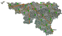
WALCORS, le réseau de positionnement par satellites permettant de déterminer précisément la position topographique de tout point sur le territoire wallon, est dorénavant accessible sur tout le territoire de la Belgique. Et cela, pour l'ensemble des utilisateurs de la catégorie SURVEY. Pour rappel, FLEPOS (Flemish Positioning Service) couvrait déjà l'ensemble du territoire belge. L'extension du réseau pour WALCORS, fournit donc des solutions alternatives en cas de problème de l'un ou l'autre réseau régional. En savoir plus sur le réseau WALCORS
WALCORS, le réseau de positionnement par satellites permettant de déterminer précisément la position topographique de tout point sur le territoire wallon, est dorénavant accessible sur tout le territoire de la Belgique. Et cela, pour l'ensemble des utilisateurs de la catégorie SURVEY.
Pour rappel, FLEPOS (Flemish Positioning Service) couvrait déjà l'ensemble du territoire belge.
L'extension du réseau pour WALCORS, fournit donc des solutions alternatives en cas de problème de l'un ou l'autre réseau régional.
En savoir plus sur le réseau WALCORS
Conférence Inspire 2017 - Oral Presentation - 07 september - European ineroperability framework - Konstantinos Bovalis
- Salon/Conférence/Colloque
- Geoportail de la Wallonie
14h00 - 07 septembre - Salle "Amsterdam" The European Commission has recently adopted the European Interoperability Framework (EIF) (COM (2017) 134). The document presents a common approach on how to deliver European public services in an interoperable manner. The approach has been agreed with the EU Member States and other stakeholders through a series of consultations. The EIF will contribute to the establishment of the Digital Single Market and to the increase of Europe's potential and competitiveness. The new EIF puts emphasis on how interoperability principles and models should apply in practice. It also considers related emerging policies and gives emphasis to end-user needs. The framework puts a strong focus on openness and information management, data portability, interoperability governance and integrated service delivery. The document provides 47 specific recommendations to facilitate the alignment of National Interoperability Frameworks (NIFs) to the EIF. If no action is taken in this sense, Member States, in their effort to meet current challenges quickly, may opt for individual and divergent NIFs. This would lead to incompatible solutions that may increase digital fragmentation across the EU and hinder the realisation of the Digital Single Market. We are aware of the complexity of the alignment process. To help the Member States with this task, we offer them assistance through the National Interoperability Framework Observatory (NIFO). The NIFO provides information about NIFs and related interoperability and digital strategies/policies to help public administrations to share and reuse experiences and to support the transposition of the EIF nationally. Thanks to the NIFO, we have learnt some success stories of alignment of National Interoperability Frameworks to the EIF, with the consequent benefits for public administrations, businesses and citizens: • The revamped Belgian Walloon geo-portal centralises the region's geographic data and aims at promoting their reuse. This new version includes the WalOnMap tool for dynamic visualisation of the entire catalogue of publicly accessible geodata. • The Audit Guide has been published by Spanish Public Administrations to help assessing the compliance with the National Interoperability Framework (Esquema Nacional de Interoperabilidad – ENI) through a list of controls. • On the way to further development is the electronic exchange between public authorities and citizens; Denmark’s work to prepare and procure a Digital Post solution has started. The so-called Next generation Digital Post (NgDP) will emerge from this process. http://inspire.ec.europa.eu/conference2017
14h00 - 07 septembre - Salle "Amsterdam"
The European Commission has recently adopted the European Interoperability Framework (EIF) (COM (2017) 134). The document presents a common approach on how to deliver European public services in an interoperable manner. The approach has been agreed with the EU Member States and other stakeholders through a series of consultations. The EIF will contribute to the establishment of the Digital Single Market and to the increase of Europe's potential and competitiveness.
The new EIF puts emphasis on how interoperability principles and models should apply in practice. It also considers related emerging policies and gives emphasis to end-user needs. The framework puts a strong focus on openness and information management, data portability, interoperability governance and integrated service delivery. The document provides 47 specific recommendations to facilitate the alignment of National Interoperability Frameworks (NIFs) to the EIF. If no action is taken in this sense, Member States, in their effort to meet current challenges quickly, may opt for individual and divergent NIFs. This would lead to incompatible solutions that may increase digital fragmentation across the EU and hinder the realisation of the Digital Single Market.
We are aware of the complexity of the alignment process. To help the Member States with this task, we offer them assistance through the National Interoperability Framework Observatory (NIFO). The NIFO provides information about NIFs and related interoperability and digital strategies/policies to help public administrations to share and reuse experiences and to support the transposition of the EIF nationally.
Thanks to the NIFO, we have learnt some success stories of alignment of National Interoperability Frameworks to the EIF, with the consequent benefits for public administrations, businesses and citizens:
• The revamped Belgian Walloon geo-portal centralises the region's geographic data and aims at promoting their reuse. This new version includes the WalOnMap tool for dynamic visualisation of the entire catalogue of publicly accessible geodata.
• The Audit Guide has been published by Spanish Public Administrations to help assessing the compliance with the National Interoperability Framework (Esquema Nacional de Interoperabilidad – ENI) through a list of controls.
• On the way to further development is the electronic exchange between public authorities and citizens; Denmark’s work to prepare and procure a Digital Post solution has started. The so-called Next generation Digital Post (NgDP) will emerge from this process.
http://inspire.ec.europa.eu/conference2017
iCOR atmospheric correction released!
- Produit ou service
- VITO remote sensing
The iCOR atmospheric correction is now available as plugin in the SNAP toolbox for the correction of Sentinel-2 and Landsat-8 images iCOR, an image atmospheric correction algorithm for land and water (previously known as OPERA (Sterckx et al., 2015)), is made available to the broad user community through the ESA Sentinel Application Platform (SNAP). This version allows the atmospheric correction of Landsat-8 and Sentinel-2 imagery. iCOR is scene and sensor generic and can process images containing land, coastal, inland and transitional water pixels. Through the use of a single atmospheric correction implementation, discontinuities in the reflectance between land and the highly dynamic water areas are reduced. iCOR is user-friendly and requires minimal manual interaction as the tool tries to retieve all the needed information from the image itself. Neverthess, the user is free to play with some options, like cloud or water detecting settings, or enabling the correction of adjacency effects over land and/or water. The performance of iCOR has been extensitively tested in different research projects (INFORM , HIGHROC and SPONGE) and in the ACIX Atmopsheric Correction Inter-comparison Exercise organised by ESA-NASA. The current release is available for Linux and Windows platforms. See the blog
The iCOR atmospheric correction is now available as plugin in the SNAP toolbox for the correction of Sentinel-2 and Landsat-8 images
iCOR, an image atmospheric correction algorithm for land and water (previously known as OPERA (Sterckx et al., 2015)), is made available to the broad user community through the ESA Sentinel Application Platform (SNAP). This version allows the atmospheric correction of Landsat-8 and Sentinel-2 imagery.
iCOR is scene and sensor generic and can process images containing land, coastal, inland and transitional water pixels. Through the use of a single atmospheric correction implementation, discontinuities in the reflectance between land and the highly dynamic water areas are reduced. iCOR is user-friendly and requires minimal manual interaction as the tool tries to retieve all the needed information from the image itself. Neverthess, the user is free to play with some options, like cloud or water detecting settings, or enabling the correction of adjacency effects over land and/or water.
The performance of iCOR has been extensitively tested in different research projects (INFORM , HIGHROC and SPONGE) and in the ACIX Atmopsheric Correction Inter-comparison Exercise organised by ESA-NASA.
The current release is available for Linux and Windows platforms.
Proposer une actualité
Ajoutez votre actualité parmi celles du Géoportail de la Wallonie et partagez vos news avec toute la communauté !