Geocortex User Conference 2016
- Conférence / Colloque / Séminaire
- SIGGIS
"Moving forward to stay current" The Web GIS landscape is changing continuously and so are our solutions. Join us on November 7 to learn how we are realizing better mobile and Web GIS solutions based on Geocortex. Learn how others solved integration problems and discuss the road ahead with the developers of the product. See you next month? Pour plus d'informations visitez le site : http://gisconferentie.be/
"Moving forward to stay current"
The Web GIS landscape is changing continuously and so are our solutions. Join us on November 7 to learn how we are realizing better mobile and Web GIS solutions based on Geocortex.
Learn how others solved integration problems and discuss the road ahead with the developers of the product. See you next month?
Pour plus d'informations visitez le site : http://gisconferentie.be/
"The Bright Side of Remote Sensing", a workshop on Sentinel 2 and 3
- Conférence / Colloque / Séminaire
- Belgian Science Policy office (BELSPO) + European Space Agency (ESA)
Undoubtedly you have heard about the Copernicus programme and the Sentinel missions. Copernicus is Europe’s flagship Earth observation programme. It aims to provide accurate, timely and easily accessible information to improve the management of the environment, understand and mitigate the effects of climate change and ensure civil security. The Sentinel family of satellites is being developed by ESA to meet the operational needs of the programme. Most likely, though, you still have a lot of questions: Where can I get the Sentinel data? What skill level is needed to use them? How good are they really? Who uses them and to what end? , … We try to facilitate your way through the world of the Sentinels. That’s why last year, you were invited to attend "The Dark Side of Remote Sensing", a workshop featuring ESA's Sentinel-1 radar mission. This year "The Bright Side of Remote Sensing" workshop will focus on the mostly optical Sentinel-2 and Sentinel-3 missions. The workshop’s morning session will deal with the missions and data access, while the afternoon session will be dedicated to potential applications and uses. Live demonstrations of the data access hub will be given during the breaks. People from academia, administrations and industry interested in remote sensing are welcome to attend. Info : www.sentinel-belspo.be
Undoubtedly you have heard about the Copernicus programme and the Sentinel missions. Copernicus is Europe’s flagship Earth observation programme. It aims to provide accurate, timely and easily accessible information to improve the management of the environment, understand and mitigate the effects of climate change and ensure civil security. The Sentinel family of satellites is being developed by ESA to meet the operational needs of the programme.
Most likely, though, you still have a lot of questions: Where can I get the Sentinel data? What skill level is needed to use them? How good are they really? Who uses them and to what end? , …
We try to facilitate your way through the world of the Sentinels. That’s why last year, you were invited to attend "The Dark Side of Remote Sensing", a workshop featuring ESA's Sentinel-1 radar mission.
This year "The Bright Side of Remote Sensing" workshop will focus on the mostly optical Sentinel-2 and Sentinel-3 missions. The workshop’s morning session will deal with the missions and data access, while the afternoon session will be dedicated to potential applications and uses. Live demonstrations of the data access hub will be given during the breaks.
People from academia, administrations and industry interested in remote sensing are welcome to attend.
Info : www.sentinel-belspo.be
Esri Days 2016
- Conférence / Colloque / Séminaire
- Esri Belux
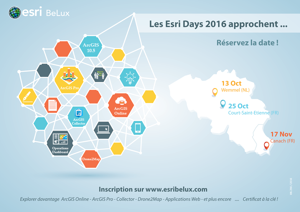
Les Esri Days 2016 représentent une occasion unique de découvrir en live toutes les nouveautés de la plateforme ArcGIS, de rencontrer nos spécialistes et de partager vos expériences en SIG. Plus d'infos ici. Inscription gratuite et obligatoire.
Les Esri Days 2016 représentent une occasion unique de découvrir en live toutes les nouveautés de la plateforme ArcGIS, de rencontrer nos spécialistes et de partager vos expériences en SIG.

Plus d'infos ici. Inscription gratuite et obligatoire.
Drones: réglementation & application
- Conférence / Colloque / Séminaire
- Agoria Bruxelles
L'écosystème émergent des drones présente de nouvelles opportunités pour les entreprises belges, tant du côté des fournisseurs que de celui des utilisateurs. Voulez-vous en savoir plus ? Joignez-nous le 20 octobre chez Agoria. Plus d'informations et inscription sur : www.agoria.be/rsevent
L'écosystème émergent des drones présente de nouvelles opportunités pour les entreprises belges, tant du côté des fournisseurs que de celui des utilisateurs.
Voulez-vous en savoir plus ? Joignez-nous le 20 octobre chez Agoria.
Plus d'informations et inscription sur : www.agoria.be/rsevent
GeoDATA 2016 Brussels
- Conférence / Colloque / Séminaire
- GeoAware
GeoDATA 2016 Brussels is part of the FREE-to-attend GeoDATA event series offering a content-rich seminar programme and accompanying exhibition for the geospatial community. It doesn't matter whether you are new to the industry or an accomplished practitioner - this really is a must-attend for all. Not just because it has forward-thinking speakers and leading suppliers exhibiting but because it offers you a day of ideas, inspiration, tools and tactics to help you get the most out of your geospatial investment. More info
GeoDATA 2016 Brussels is part of the FREE-to-attend GeoDATA event series offering a content-rich seminar programme and accompanying exhibition for the geospatial community.
It doesn't matter whether you are new to the industry or an accomplished practitioner - this really is a must-attend for all. Not just because it has forward-thinking speakers and leading suppliers exhibiting but because it offers you a day of ideas, inspiration, tools and tactics to help you get the most out of your geospatial investment.

